The fort was more than a military outpost; it was a trading post and fortified village as well, containing storehouses and civilian dwellings. Surrendered to the British at the end of the French and Indian War in 1761 it was captured during Pontiac's Rebellion in 1763 and held by the Ojibwa Indians for a year until the British negotiated its return. The British decided that the position was too exposed and moved the fort and the town across the Straits to Mackinac Island but (confusingly) kept the name of the fort Michilimackinac, after establishing the position on Mackinac Island they burned the remains of the original fort.

the fort as seen by Google Earth

the fort as seen by a visitor approaching on the beach from the east

a slightly closer view

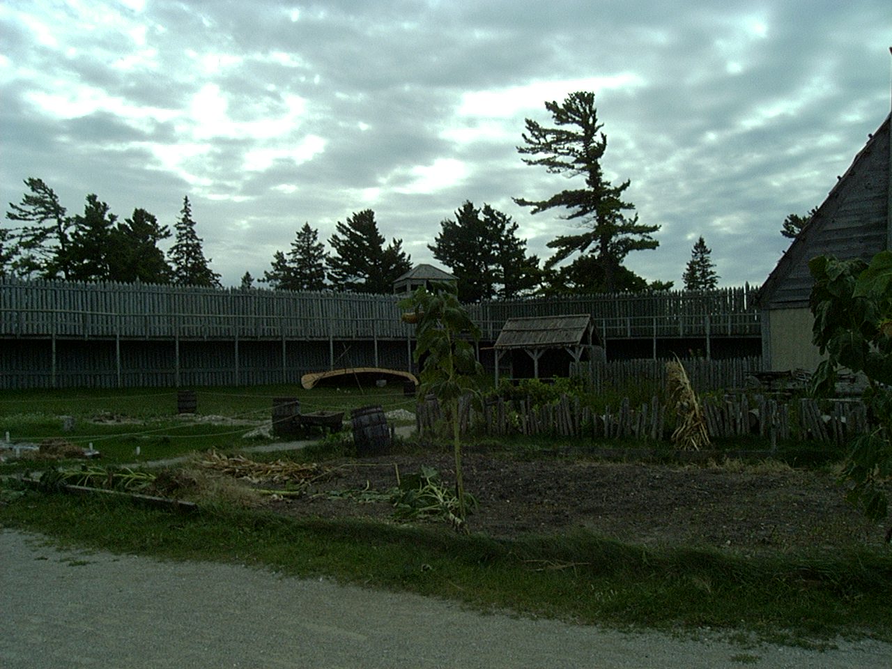
the fort blends in with the surroundings,
if it wasn't for its unique location it would be easy to miss from the water

despite it being August the day was windy and chilly

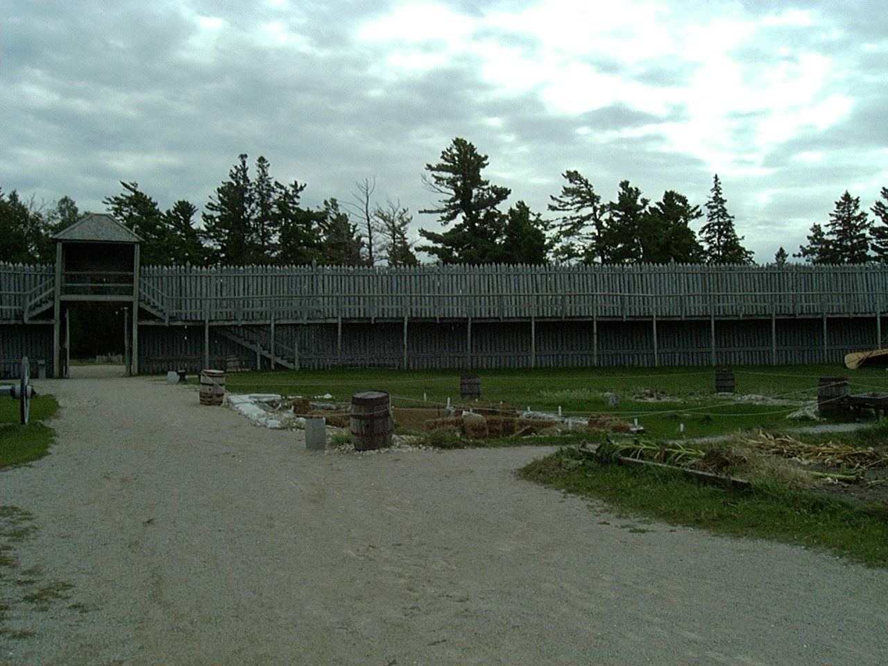
looking west from the front of the fort

the beaches are shallow and sandy

the north east corner of the fort

I hesitate to call it a bastion, more like a tower or sentry post

looking south along the eastern wall

a closer look at the northeastern tower

the northern gate

looking west along the northern face from the northern gate

a closer look at the northern gate

the Commanding Officer's House

the northern gate from the inside

the inside of the northern wall looking east from the northern gate

just west of the main north-south roadway is the King's Storehouse (left)
and the Guardroom with its unusual arched porch

the King's Storehouse is an unimaginative, but functional, structure

looking west along the pathway just south of the storehouse

the hearths are massive stone affairs, they hold the heat of
the fire and act as a passive heater once the fire has burned out

uniformed staff explaining the niceties of musketry drill to visitors

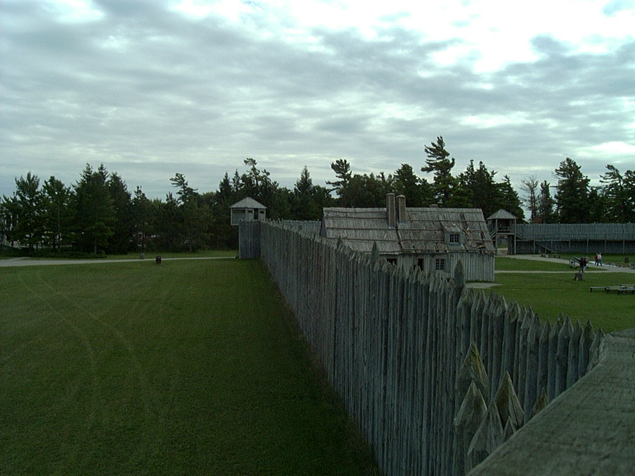
looking west along the interior of the north wall
just to the west of the main north-south street

looking south from the same position;
long barracks to the left, guardroom to the right

another view of the Commanding Officer's house

a neat "child-interactive" sign

interior of the guardroom

the Parks Service has gone to considerable lengths to make the mannequins realistic

the row of trader's shops/residences

interior shots of the same

the upstairs of a trader's house, I think that I would want
more supplies if I was looking at spending a winter in the north of Michigan

a view to the north from that upstairs window;
guardroom the left, long barracks to the right

interior of the Church of Saint Anne


the priest's quarters


the blacksmith's forge


more domestic housing, there is an interesting underground passage between two
of the buildings that showcases the archaeology that has taken place here at the fort

the priest got his own home, it was attached to the church

another look at the guardroom

the front porch is unlike any other building of the period that I have seen

inside the long barracks

more massive fireplaces

glass for windows must have been incredibly expensive this far into the interior
but was crucial given the harsh winters

inside the Commanding Officer's house

spartan, to say the least

trade goods, European cloth and metal goods were the basis of trade

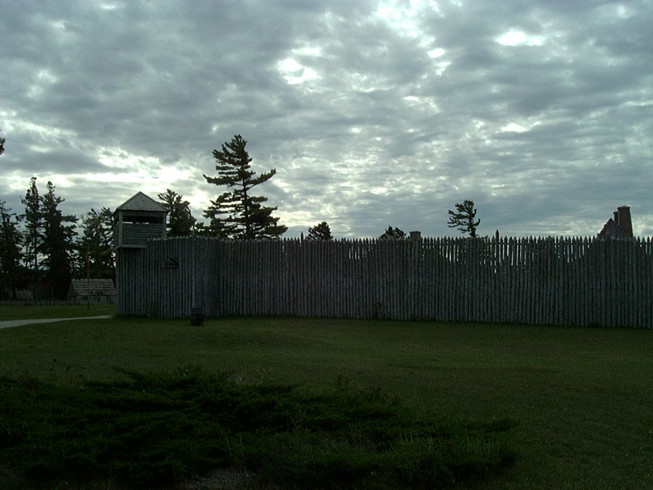
the northwest tower from the center of town

one of the displays cataloged the series of forts that were built at the Straits
did I ever mention that I love models like this?

and the accompanying information placard,
the artwork was particularly well done

is demonstrated by the houses packed into the narrow confines of the walls


I really like the models


maybe I will one for myself , except that it would
be on par with the Castillo model for size (and storage)


the Piquet House
the vertical log construction of the homes was a French technique


clay-packed wattle was a poor-man's chimney

interior of the Piquet House


the latrines, no privacy here!

outside of the latrines

a lot of cooking was done outside during good weather

gardens provided the Europeans with familiar vegetables
looking southwest from the center of town
looking south from the same

looking dead south from the center of town

panning to the east

looking southeast

and straight east from the center of town

across the Parade Ground toward the northeast

the northeast tower

looking north toward the Commanding Officer's house and the north gate

straight north; long barracks on the left, Commanding Officer's house to the right

not a lot of frills when it comes to the barracks building

continuing to turn counter-clockwise, the back of the church

the Chevalier House

apparently experiencing some structural issues


these structures also contain another underground passage that interprets the excavation
of the powder magazine and the weapons that were used at the fort

a wall gun, it is almost seven feet long and has a bore over an inch

French and British muskets


the southeast tower

small cannon were mounted in the tiny bastions that supported the corner towers

the view outward, keeping the brush cut back away from the fort must have been a constant task

a view from the cannon port looking north along the exterior of the east wall

looking south along the interior of the east wall from the northeast tower

the trader's quarters from the top of the south gate,
the grassy area in the foreground would have been occupied by additional housing

looking straight north from the top of the south gate

looking to the northeast from the top of the south gate


looking east along the interior of the south wall from the south gate

the powder magazine was buried underground and closed with a heavy wooden door

of course, it was kept locked

looking south along the exterior of the east wall from the northeast tower

construction details (I doubt that the French had use of modern steel bolts, upper left)
wooden pegs stood in for nails

the view west along the outside of the south wall from the musket port in the southeast tower

there was a considerable amount of housing and farming in the area of the fort

looking north along the east wall

the interior from the wall walk

the long barracks viewed across the Parade Ground from the wall walk on the eastern wall


the entry to a tower, most likely there was a ladder here instead of a stairway

looking west from the northeast tower

and north

and to the east we find the Mackinac Bridge
south along the eastern wall from the northeast tower

the Parade Ground from the northeast tower

looking west along the north wall from the northeast tower

musket port at wall walk level (about ten feet above ground level)
simple but effective

domestic gardens

looking east along the north wall from the north gate

looking southeast from the northwest tower

space was at a premium and there were no cars, lanes could be narrow

looking east from the center of the west wall walk

more domestic gardens

the area that was under investigation by archaeologists when I visited

interior gate details

looking west from just outside the south gate

looking east from just outside the south gate

looking north at the south gate

a closer view of the same

a typical French habitant's house

farming must have been difficult given the short summer and poor soil

the east wall and northeast tower

a surprising amount of daylight gets through the palisade

the south gate

southeastern tower and east wall looking north into the Straits
the eastern wall, notice the cloud cover, this photo was taken minutes after the previous one,
the weather can turn suddenly due to the local geography


a native wigwam, they probably didn't have access to plastic tarps back in the day

an "art-shot" the northeast tower through the trees
The fort is the site of the longest-running archeological excavations in the State of Michigan, having been under continuous study since 1959. Completion of the digging is normally followed by a reconstruction of the building that had been investigated.
Located on the northernmost tip of Michigan's Lower Peninsula it is just west of the mighty Mackinaw Bridge. The Historical Society runs a very impressive gift shop and publishes the findings of the excavations as they are reported yearly. A surprising number of diaries and records have survived the centuries and are also available as reprints. A look at their published materials is well worth the time. Another way to spend some time on the internet is to look at the Mackinac State Historic Parks website (in truth it is worth going to just for the drone overflights of the forts). But, nothing matches a visit, if you are anywhere near the Straits take a day or two and visit all three of the forts.
Great post. I haven't been there since Marsha and I first got married...
ReplyDelete