Fort Holmes, courtesy Google Earth
the relationship of Fort Holmes to Fort Mackinac,
the island was largely farmland back in 1812 and there were far fewer trees
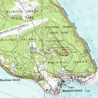
a USGS map of the island, it is easy to see how much higher Fort Holmes
is in relation to Fort Mackinac
a ground-level view of the fort, the vertical logs act as
a retaining wall to a substantial earthen embankment
a view from the approach road
the inevitable historical marker
the approach and gateway, there is a fairly deep ditch around the fort that the soil for
the embankment was drawn from, it effectively adds several feet to the height of the wall
a closer view
an interior view of the firing step, I doubt that there was a railing in the original fort,
such atavistic encumbrances are required by law now but there was no OSHA back in 1812
the blockhouse, the large dark windows on the upper lever are cannon ports
the firing step without railings; far more historical, and loads more fun for kids to play on!
the view down the cutting toward Fort Mackinac
a slightly closer view
there is a lot of wall for a fort with such sparse accommodations
I doubt more than forty or fifty men could be housed in the blockhouse
it is roughly thirty feet on a side
interior framing of the lower floor
the canted upper story proved all-around fire without the extra effort of building bastions
a nice aerial view
an old map of both forts
somebody in the Parks Service has a sense of humor;
the restroom maintains the fort's esthetic
If you get a chance to visit Mackinac Island be sure to take the time and climb the hill to Fort Holmes, the view is magnificent and nobody will be there trying to sell you fudge.


No comments:
Post a Comment