With the fall of Detroit to the British this area became the far Northwestern corner of the US position in the War of 1812. Built in the first few months of 1813 under horrific weather conditions by a mixed force of Regulars and militia it was completed just in time to thwart the advancing British and their Native American allies. The replica fort was built, and is maintained by, the Ohio History Connection in conjuction with the Fort Meigs Association.
Surrounded by a circuit of almost 2500 yards this is a truly major fortification for the location and period, I found myself marveling at the industry and sense of purpose that the original builders must have brought to their task. The fort was built to overlook the rapids of the Maumee river, in a period when rivers functioned as highways this was a vital choke-point and the fort could control the passage of troops and supplies upriver.
Below is a picture of the fort as it is today, courtesy Google Earth. The walk-through follows the path in a clockwise route from the western entrance.

The fort has a visitor center/museum that is well done and nicely appointed. there is an explanatory video presentation, a well-stocked bookastore, and a very thoughtfully laid out museum that traces the local history and places the fort in the context of the frontier at the time of the War of 1812 along with the prior conflicts between the Native Americans and the nascent United States.

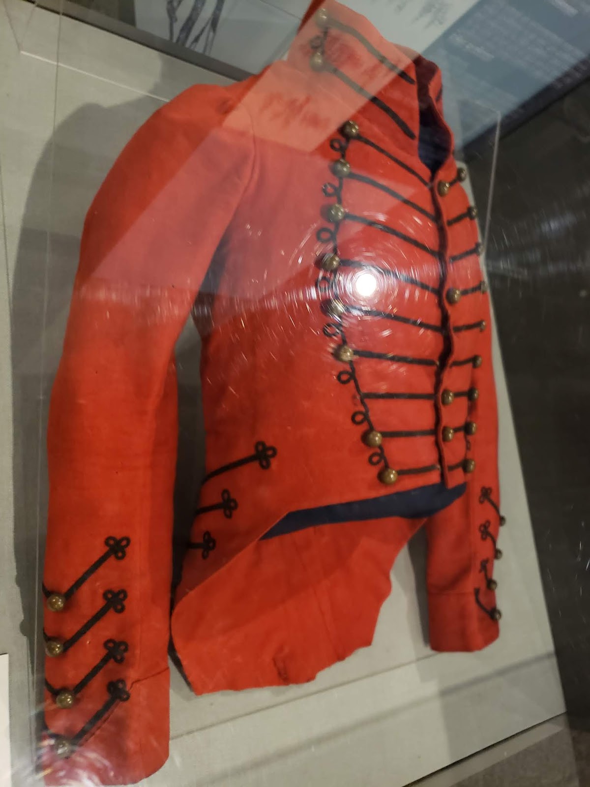
I understand the need to protect valuable original items
but I abhor flat-panel glass cases as they make photography almost impossible


the Light Dragoon saber (bottom) was stunningly large


brilliant artwork, I will have to track down the more of this artists work


infantry and artillery swords were a much more manageable size


this museum fed my map-fetish


as modellers and painters we should keep in mind
that most barrels were new and looked like these

more forts that I never knew about!

looks like an easy scratch-build..........
The Fort

of course the fort would have been fresh-cut timber
as it was only finished days before the British began the first siege

the stockade appeared deceptively short, upon closed examination it is on the top of a earthen berm about five feet tall which is quite steep, I would not want to trying to fight my way past any sort of defense to gain entry, at the time of the siege it would have been naked slick clay


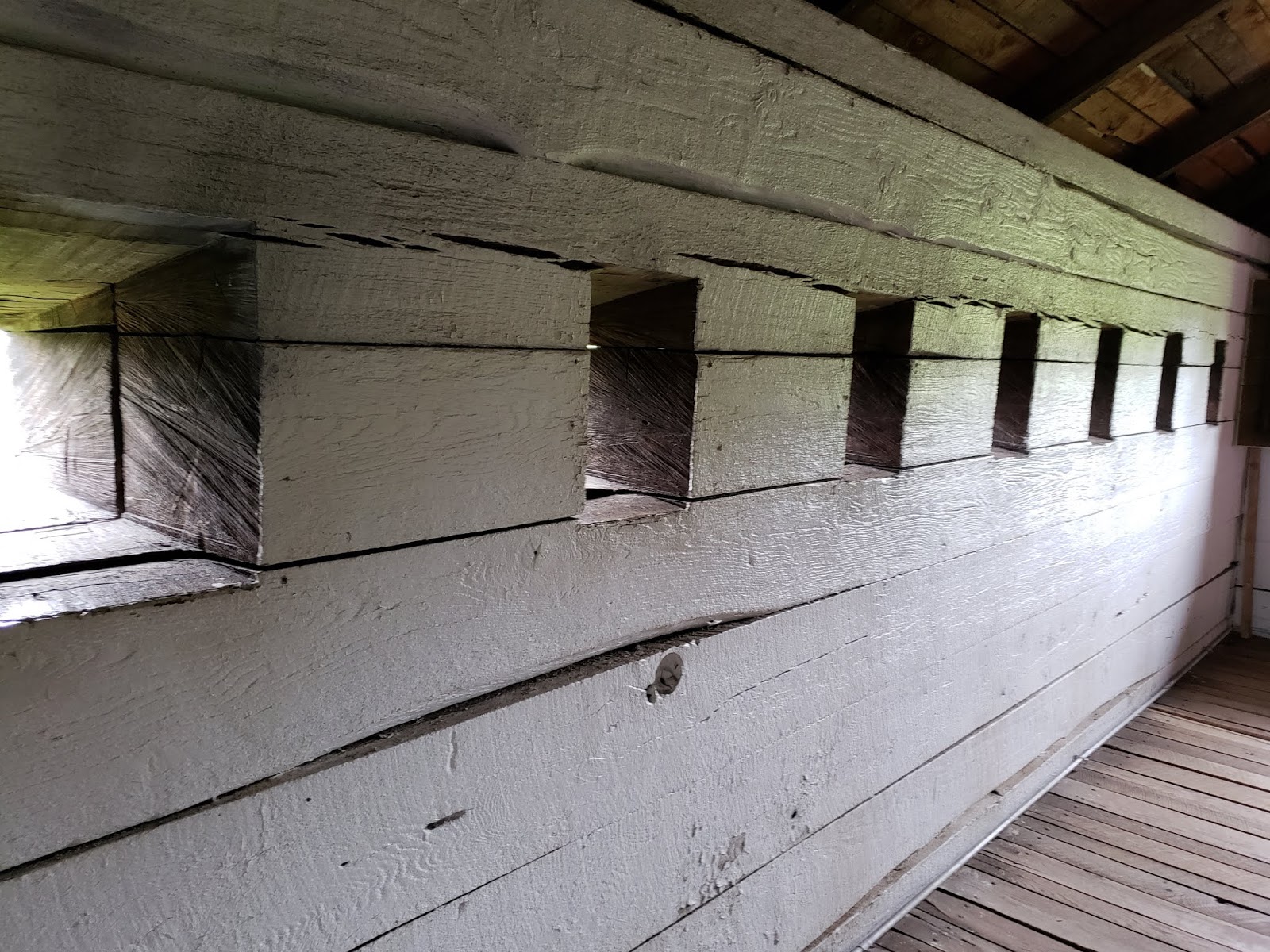
the dark slots near the base of the towers are cannon ports,
one can imagine the sort of havoc a blast of grapeshot would have inflicted along this wall

just inside the western gate, a glance to the south

and one to the north

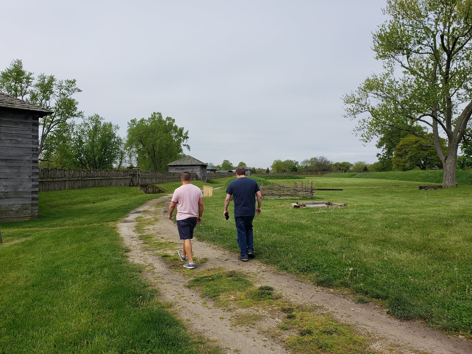
the monument in the center of the fort and some of the traverses


we walked clockwise around the interior,
this is the first gun battery we encountered

a look back at the blockhouse, if the fort was entered the blockhouses
had effective fields of fire into the interior and could continue to resist the attacker


a look down the precipitous bluff to the Maumee River, we were there 206 years
(and a week) after the siege, the river was in flood state and had spilled over into the flood plain


a look along the battery face


the gates struck me as terribly flimsy until I looked down the steep slope
and realized there was little likelihood of anyone bringing a ran up here


looking toward the east and the next gun position


the lack of stockade confused me until I looked down the very steep bluff below this battery


moving along to the next bloskhouse

these were constructed of two layers of foot-thick logs


the interior of the blockhouse


a view out the gun port over the cannon barrel


a shutter over the interior of the cannon port

a musket loophole, you can get an idea how thick the log wall were from this view


the view from the loophole

interior structure


the view into the interior of the fort


the traverses were built to stop British cannon balls that went over the
wall from rolling all the way across the interior

shutter of an interior window

the same barred shut


the gray stone building was an old visitor's center (I think)
it was not part of the original fort and is now being used as a workshop


a cannon in the northeast battery


views from that northeast battery


views across the interior from the northeast battery


views along the eastern wall


early Article 15 discipline methods

inside the blockhouse there were examples of the Enlisted Men's tents

and those of the officers


a grimly amusing roulette wheel of ways that you could die while stationed here,
I died of the Ague


views along the southern wall


there is a deep declivity on the southern side as well


looking east along the southern wall

and west from the same location


a view through the southern gate

inside another blockhouse was a nice display which featured this excellent waterccolor

and more maps


after the British withdrew following the second siege the original
fort was torn down and rebuilt into a much smaller outpost about fifty yards square


inside yet another blockhouse was a magnificent display depicting the
construction of the fort in the bitter winter conditions of early 1813

this was built in roughly 1/30th scale


this gives a better idea of the steepness of the slope down to the river


abbatis; trees felled toward the direction of the expected attack
were an early form of barbed wire and much harder to cross


of course there was more map-porn

which I love!


If you found this walk-around interesting I have posted several other of my visits to forts on my Fortified Places tab
No comments:
Post a Comment