
a look at the blockhouse from our friends at Google Earth
the left half is the original military fort,
the right half is the rather ramshackle civilian trading post that grew next to the blockhouse
Built in 1794 to "protect" the Cherokee from encroaching settlers the Blockhouse served as the official liaison point between the United States Government and the Overhill Cherokee people. The Blockhouse stayed in service from 1794 until 1807. Today it is surrounded by water from a TVA dam built in the 1930's it originally was near the top of a large ridge. Several significant treaties were signed between the Cherokee and the U.S. government and the Blount Conspiracy was initially exposed there as well. You can find further information on this Wiki post and on the State Park's website.

photo pathway

looking downhill from point 1

placard at point 1


and a model of the fort in it's heyday,
protected by the inevitable museum-quality ultra-high-glare glass

this model is located at the Fort Loudon State Historic Park
(just across the lake from Tellico Blockhouse)


uncertainty among the archeologists as to the manner of construction
has prevented a reconstruction of the Blockhouse
photo from point 2


can't complain about the scenery!

the front gate from point 3


location of the front gateposts

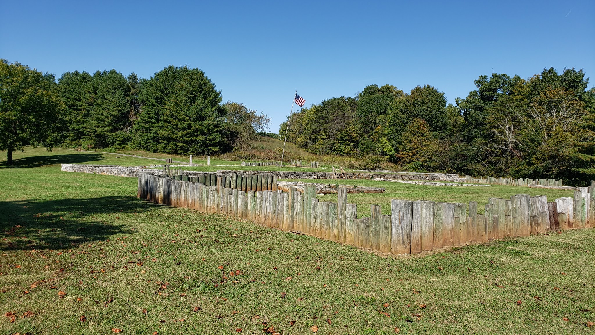
point 4 looking north
the stone foundations of the barracks and offices with the well
and the footings for the blockhouse corner tower in the distance

point 4 looking northeast

point 4 further east across the parade ground

point 4 straight east

point 4, to the southeast

point 4 looking south southeast

point 4 looking south along the barracks foundations

point 5 looking north,
the foundation line would have been topped with a wooden wall
about eight to twelve feet high

point 5 looking northeast,
the near corner is the foundation for the blockhouse

point 5 looking east

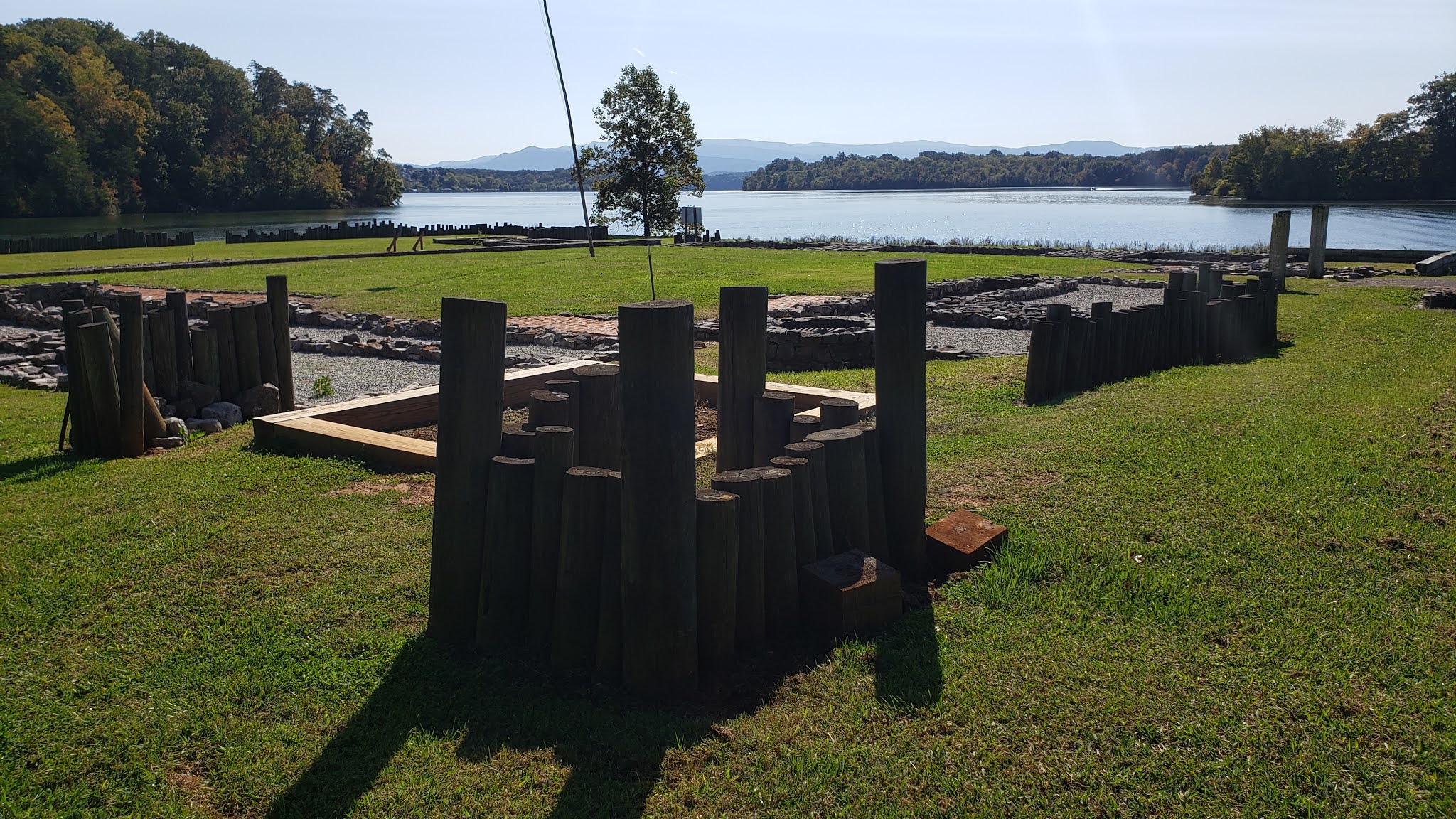
another glance at that lake,
at the time of the Blockhouse's operation there would have been a steep valley
falling away into a rocky swift-running river

point 6 looking northwest

point 6 looking north across the parade ground

point 6 looking to the northeast
point 7 looking to the northwest
across the area that contained the civilian trading post

point 7 looking north northwest
the palisade would have been at least eight feet high along this section

point 7 looking north

point 9 looking south

point 9 looking southwest

point 9 looking west
the irregular nature of the civilian settlement can be easily spotted by the layout of the foundations
they pay little heed to the military considerations of fields of fire and blind-spots

point 10 looking south

some civilian foundations were simply logs laid upon the ground
much like Saxon longhouses circa 800AD

point10 looking to the southwest

and looking to the west

point 11 looking southwest, other foundations were quite substantial,
that the military allowed civilian structures to directly abut the fortification
either speaks of reliable peacefulness or reckless self confidence

point 11, looking south

point 11, to the southeast

point 12 looking to the east southeast
barracks foundations in the left distance and a sample "dig pit" in the near foreground
the log pilings indicate the corners of the large blockhouse that contained the well
point 12 looking to the southeast

point 12 looking south along what would have been the front wall of the fort

point 4 looking north along the fitted stone foundation

point 4 looking south
the massive pile of stone in the center of the foundation is the base for the chimney

point 13, looking west from the center of the parade ground
through the front gate

point 13, panning to the southwest

point 13 looking south

point 13 looking southeast

and a little further east

point 13 looking straight east


point 13 looking straight north


point 14, a closer look at the foundations,
the interior fireplaces built back-to-back stored heat in the mass of the stonework
and released it slowly through the night providing comfort even after the fire had gone out

the foundations for the southwest exterior wall
(and perhaps a blockhouse)


point 15 looking west along the barracks foundation


point 15 looking south, this may be a well,
or it may be a feature of the modern drainage system
I can't say for certain, but it's location looks suspiciously modern

point 15 looking southeast into the civilian area

point 16 looking northeast at the footings for one of the civilian buildings
given the time and place this would have been a luxurious home

point 16 looking southeast

point 16 looking east

point 16 looking northeast

a closer look at that foundation

point 17, the same foundation from another direction

point 17 looking east

point 17 looking north

point 17 looking at the square foundation abutting the fort wall,
the style and position of the foundation argues that it is a later addition

point 18, another suspiciously modern-looking drain structure

point 18, a closer examination if the foundations along the north wall of the fort

more of the same

the far western end of the foundation

looking back east along the foundation

point 12 looking south
I have to confess that I was a bit let-down by the lack of a reconstruction at this site. The method of military architecture for this period is well-enough known that they could have modeled it on the Fort Stueben reconstruction and have been well within reason. Truth be told, I think that the State (quite reasonably) decided that two reconstructed forts within a twenty minute drive of each other (and mutually visible across the lake) would have been a bit much and decided to rebuild the sexier early fort. I can't complain as the Fort Loudon rebuild is magnificent. I will say that if you are visiting Fort Loudon, spend an hour and see Tellico Blockhouse, at the very minimum the views are delightful.
I'd love to pay a visit to see this fort.
ReplyDeleteWow. That is only a few miles from where we are going shortly. My wife sister is in Teleico. Looks like I will be at the park on Thursday
ReplyDeleteFort Loudon is just across the lake, not a quarter-mile away.....but the drive around the lake will take a half-hour or so, Loudon is well worth a visit too
Delete